
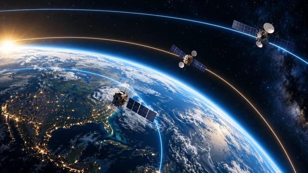
Every satellite orbiting Earth follows a carefully selected path. Some travel only a few hundred kilometers above the surface, completing an orbit in roughly 90 minutes. Others operate more than 35,000 kilometers away, appearing almost motionless in the sky. These differences are fundamental to how satellites communicate, observe Earth, provide navigation, and support scientific research.
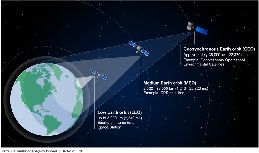
Consider three familiar examples. The International Space Station (ISS) operates approximately 400 kilometers above Earth, where it supports human spaceflight and research. GPS satellites operate around 20,200 kilometers above Earth, enabling positioning and timing services worldwide. Meanwhile, geostationary weather satellites operate approximately 35,786 kilometers above the equator, continuously monitoring major weather systems.
Why do satellites orbit at different altitudes? Because altitude changes their orbital speed, revolution period, visibility, signal travel distance, imaging geometry, environmental exposure, and maintenance requirements. A satellite designed for detailed Earth imaging has different requirements from one intended to provide uninterrupted television broadcasts.
Altitude also interacts with orbital inclination, eccentricity, sensor technology, propulsion capability, and the number of satellites in a constellation. Engineers select an orbit by balancing these factors against mission objectives rather than simply choosing the highest or lowest possible altitude. [1], [2], [3]
1. What Is a Satellite, and How Does Its Orbit Work?
A satellite is an object that travels around a larger celestial body under the influence of gravity. Natural satellites include Earth’s Moon, while artificial satellites are human-made spacecraft launched for specific purposes. Their orbital motion is governed primarily by gravitational physics, but their usefulness depends on engineering decisions involving altitude, orientation, orbital shape, and payload configuration.
Understanding how satellites remain in orbit explains why their speed and period change with altitude. It also provides the foundation for comparing different orbital regimes and understanding their practical limitations.
1.1. What Is an Artificial Satellite?
An artificial satellite is a spacecraft intentionally placed into orbit around Earth or another celestial body. Sputnik 1, launched by the Soviet Union on October 4, 1957, became the first artificial Earth satellite and marked the beginning of the space age.
Modern satellites support communications, navigation, Earth observation, meteorology, astronomy, scientific research, and national security. Their equipment, called the payload, performs the primary mission, while spacecraft subsystems supply electrical power, thermal regulation, attitude control, communications, and propulsion.
A satellite’s mission profile describes what it must accomplish, which geographic areas it must serve, the quality and frequency of data required, and its anticipated operational lifetime. The orbit becomes part of the spacecraft’s functional design rather than merely its location.
1.2. Why Do Satellites Stay in Orbit Instead of Falling to Earth?
Satellites remain in orbit because their forward velocity and Earth’s gravitational attraction produce continuous free fall around the planet. Gravity constantly accelerates the satellite toward Earth’s center, while its tangential motion carries it forward as Earth’s surface curves away beneath it.
In a circular orbit, gravitational acceleration supplies the required centripetal acceleration. Under ideal conditions, a satellite does not need continuous engine thrust to remain in orbit. However, atmospheric drag and other perturbations can gradually change its trajectory.
An orbiting satellite has not escaped Earth’s gravity. In fact, gravity is essential to maintaining its orbit. Reaching an escape trajectory requires greater orbital energy than simply remaining gravitationally bound to Earth.
1.3. What Is Orbital Altitude, and How Is It Measured?
Orbital altitude describes a satellite’s height above a defined reference surface, commonly approximated using Earth’s mean radius. Orbital radius, by contrast, measures distance from Earth’s center. This distinction is essential because gravitational calculations depend on distance from the center of mass, not simply height above the ground.
For a simplified spherical Earth:
Here, r is orbital radius, RE is Earth’s mean radius of approximately 6,371 kilometers, and h is altitude.
A satellite at 500 kilometers altitude therefore has an orbital radius of approximately 6,871 kilometers. In an elliptical orbit, its altitude changes continuously between the closest and farthest orbital points.
1.4. How Are Orbital Velocity and Orbital Period Related to Altitude?
In a circular Earth orbit, satellites closer to the planet move faster than satellites farther away. This happens because Earth’s gravitational attraction is stronger at smaller orbital radii, requiring a greater circular velocity.
The circular orbital speed is:
The orbital period is:
Here, μ is Earth’s standard gravitational parameter, approximately 398{,}600 km3/\text{s}2.
These relationships follow Newtonian orbital mechanics and Kepler’s Third Law. As orbital radius increases, circular velocity decreases while the orbital period increases. A low-altitude spacecraft may complete an orbit in about 90 minutes, while a geostationary satellite requires one sidereal day, approximately 23 hours, 56 minutes, and 4 seconds. [1], [2]
Drag the slider below to calculate ideal two-body orbital velocity and revolution period at any altitude above Earth:
2. What Are the Main Types of Satellite Orbits by Altitude?
Satellite orbits can be classified by altitude, orbital shape, inclination, or their relationship to Earth’s rotation and the Sun. The principal altitude regimes are Low Earth Orbit (LEO), Medium Earth Orbit (MEO), and geostationary altitude, although many missions use specialized configurations that do not fit neatly into one category.
These classifications help engineers compare typical capabilities, but they should not be treated as rigid mission rules. Some missions combine characteristics of multiple orbital types, while others use eccentric trajectories with substantial altitude variations.
2.1. Low Earth Orbit (LEO): Why Do Satellites Fly Close to Earth?
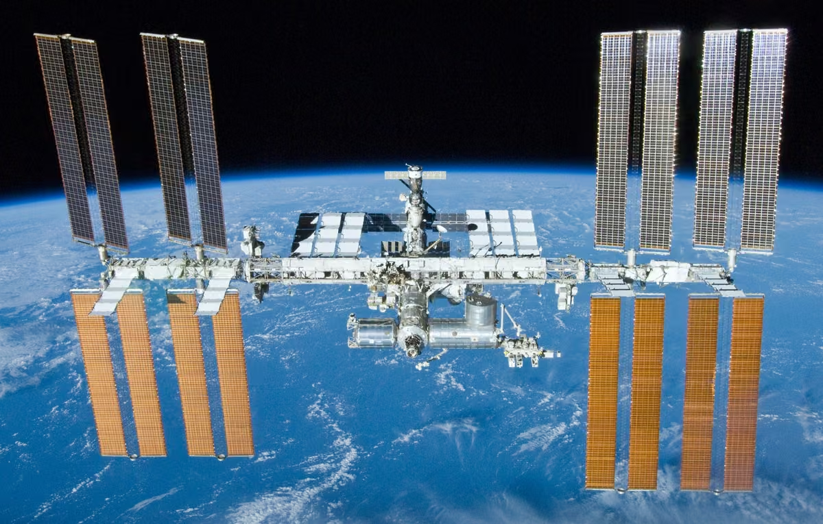
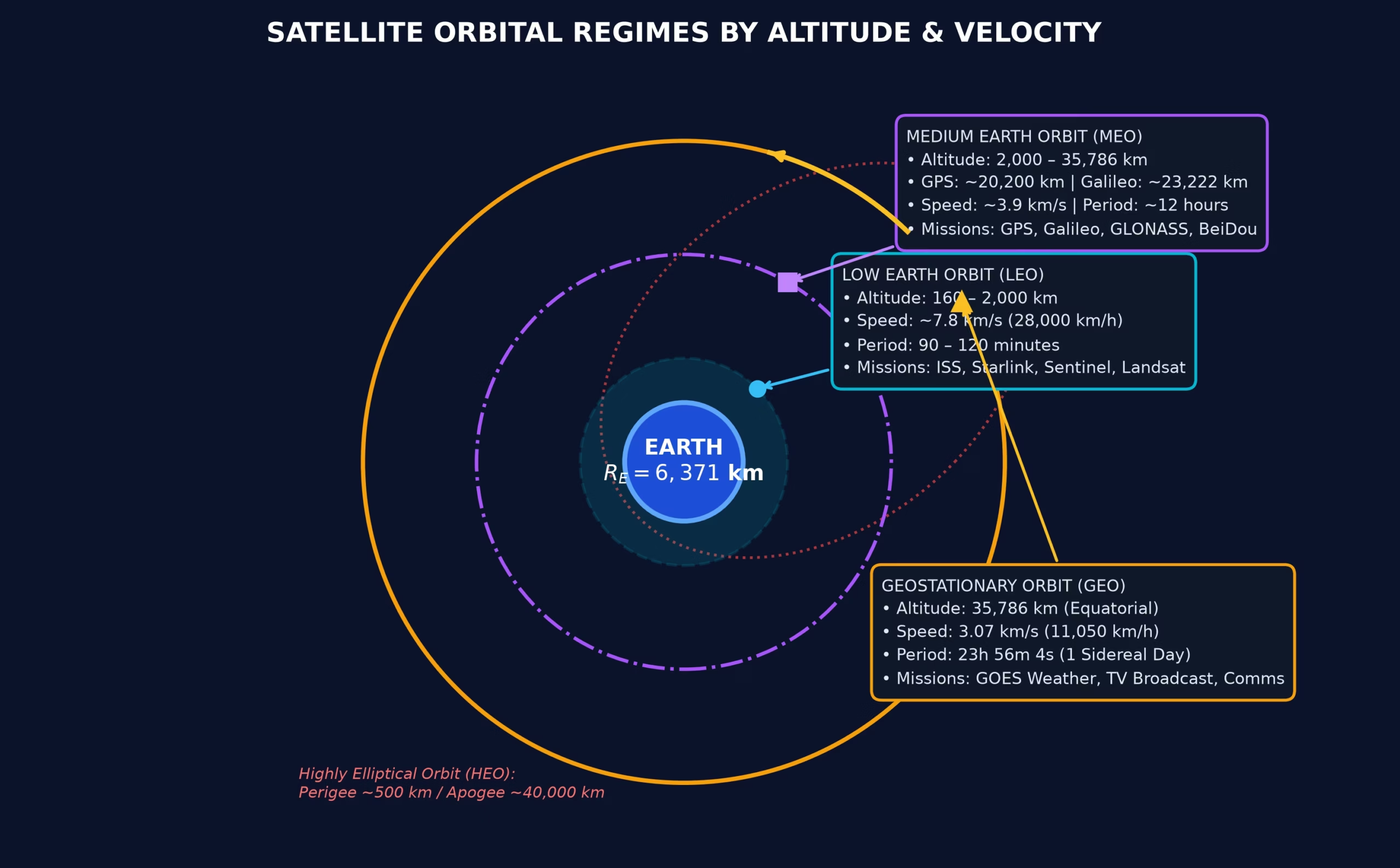
Low Earth Orbit generally refers to altitudes extending from approximately 160 to 2,000 kilometers above Earth’s surface. Satellites here travel rapidly, with orbital periods commonly ranging from about 90 minutes to just over two hours.
LEO’s proximity to Earth offers several advantages, including shorter communication paths, relatively strong received signals, and favorable geometry for detailed observation. The ISS, many Earth observation satellites, and broadband constellations such as Starlink operate in this regime.
However, individual satellites can observe or communicate with a limited region at any moment. Atmospheric drag, frequent changes in ground visibility, orbital debris, and constellation coordination also create operational challenges. [1], [2]
2.2. Medium Earth Orbit (MEO): Why Is It Useful for Navigation?
Medium Earth Orbit lies above LEO and below geosynchronous orbital altitude in the commonly used classification. It provides broader geographic visibility than low-altitude trajectories, making it attractive for navigation systems that need signals available across much of Earth’s surface.
GPS satellites operate at approximately 20,200 kilometers, while Galileo satellites use an altitude near 23,222 kilometers. GLONASS also operates primarily in MEO, and BeiDou combines different orbital regimes.
MEO presents environmental challenges, including exposure to energetic particles associated with Earth’s radiation belts. Radiation-resistant electronics, accurate orbit determination, clock stability, and appropriately distributed orbital planes are therefore central to navigation constellation design. [3], [4]
2.3. Geostationary Orbit (GEO): Why Do Satellites Appear Fixed in the Sky?
A geostationary satellite travels in a circular orbit directly above Earth’s equator, at approximately 35,786 kilometers altitude. Its orbital period exactly matches Earth’s sidereal rotation period, allowing it to remain over approximately the same geographic longitude.
This nearly stationary appearance is valuable for broadcasting, fixed satellite communications, and weather monitoring. Ground antennas can point in a constant direction, while meteorological instruments continuously observe large regions.
However, GEO has significant disadvantages. The long transmission distance increases propagation delay and free-space path loss. Earth’s curvature also restricts its view of polar regions, and satellites require orbital maintenance to remain in assigned positions. NOAA’s GOES weather satellite system is a prominent application. [2], [5]
2.4. Geosynchronous Orbit (GSO) vs. Geostationary Orbit
Geosynchronous Orbit describes any Earth orbit whose period matches Earth’s sidereal rotation period. Geostationary Orbit is a specific subset requiring zero inclination, zero eccentricity, and motion in the same direction as Earth’s rotation.
A geosynchronous orbit may be inclined or elliptical. In such cases, the satellite can appear to move north and south, or trace an elongated, figure-eight-like path in the sky rather than occupying one fixed position.
This distinction matters because having a 24-hour-like orbital period does not automatically make a satellite stationary relative to Earth’s surface. Every geostationary orbit is geosynchronous, but not every geosynchronous orbit is geostationary. [1], [2]
2.5. Highly Elliptical Orbit (HEO): Why Do Some Satellites Need Unequal Orbital Heights?
A Highly Elliptical Orbit has substantially different minimum and maximum distances from Earth. Its closest point is called perigee, while its farthest point is called apogee. Under Kepler’s Second Law, a satellite moves faster near perigee and slower near apogee.
This behavior can be exploited to provide extended visibility over particular geographic regions. Molniya orbits, traditionally involving approximately 12-hour periods and high inclinations, are well suited to high-latitude communications.
Tundra orbits typically have periods of approximately one sidereal day and can also provide prolonged northern or southern regional coverage. Their varying range and apparent motion require more complicated ground tracking and link planning than GEO.
2.6. Polar Orbit and Sun-Synchronous Orbit (SSO)
A polar orbit is an orbit with an inclination near 90 degrees, taking the spacecraft close to Earth’s poles. As Earth rotates beneath the orbital plane, the satellite can observe different longitudes on successive revolutions.
A Sun-Synchronous Orbit is engineered so that its orbital plane gradually rotates at a rate that maintains approximately the same local solar time during repeated observations. This provides similar illumination geometry for many optical imaging applications.
Landsat and Sentinel-2 use near-polar, sun-synchronous orbits to support consistent environmental monitoring. A sun-synchronous satellite typically has a retrograde inclination somewhat greater than 90 degrees, rather than following an exactly polar orbit.
Polar and sun-synchronous describe orbital geometry and motion, not independent altitude categories. [6], [7]
2.7. Satellite Orbit Comparison Table
The following comparison summarizes the principal orbital options and their mission implications. The altitude ranges are conventional classifications, not universal boundaries enforced by orbital physics. In particular, highly elliptical, polar, and sun-synchronous orbits describe properties beyond altitude alone.
| Orbit type | Approximate altitude | Main advantage | Typical applications |
|---|---|---|---|
| LEO | 160–2,000 km | Close-range sensing, low propagation delay | Imaging, research, broadband |
| MEO | 2,000–35,786 km | Broad visibility | GNSS, timing |
| GEO | 35,786 km | Continuous regional visibility | Broadcasting, weather |
| HEO | Varies through each orbit | Extended dwell near apogee | High-latitude communications |
| Polar / SSO | Often LEO | High-latitude coverage, repeatable illumination | Mapping, climate monitoring |
The orbital type that works best depends on the payload, required coverage, latency tolerance, launch constraints, and long-term operational strategy. No single orbit optimizes all mission requirements simultaneously.
Satellite Orbit Simulation Video
This animated educational video illustrates satellites, orbital inclination, altitude classifications, circular and elliptical paths, and the relationship between spacecraft motion and mission purpose. It is a conceptual visualization rather than a numerical flight dynamics simulator.
3. How Do Orbital Geometry and Motion Determine Satellite Coverage?
Altitude influences how much of Earth a satellite can see, but geographical coverage also depends on orbital inclination, eccentricity, antenna geometry, and the rotation of Earth. A satellite may pass over a location without being able to collect useful data, especially when the viewing angle or signal conditions are unfavorable.
For communications and Earth observation, engineers distinguish between geometric visibility, usable sensor coverage, and continuous service availability. These concepts are related but not interchangeable.
3.1. How Does Orbital Inclination Change the Areas a Satellite Can Reach?
Orbital inclination is the angle between a spacecraft’s orbital plane and Earth’s equatorial plane. A zero-degree inclination describes a prograde equatorial orbit, while a 90-degree inclination describes a polar orbit.
For an ideal inclined orbit, the subsatellite point reaches geographic latitudes determined by orbital inclination. For prograde inclinations below 90 degrees, this means the satellite’s ground track is confined between approximately the positive and negative inclination angles.
However, instruments and antennas may observe regions beyond the ground track through off-nadir pointing. Mission designers therefore consider both inclination and actual viewing geometry when determining geographical access.
3.2. How Does Orbital Eccentricity Change Satellite Motion?
Orbital eccentricity measures how much an elliptical orbit differs from a circle. A circular orbit has eccentricity zero, while an elliptical bound orbit has eccentricity between zero and one.
As eccentricity increases, the difference between perigee and apogee generally becomes more pronounced for a given semimajor axis. A satellite accelerates as it approaches perigee and slows as it approaches apogee.
This characteristic is especially useful for missions requiring extended visibility over selected regions. However, changing altitude also affects communications distance, viewing angle, radiation exposure, and thermal conditions, making elliptical missions more complicated to operate.
3.3. What Is a Satellite Ground Track?
A satellite ground track is the path traced across Earth’s surface by the subsatellite point, the location directly beneath the spacecraft. Because Earth rotates while the satellite travels around it, successive ground tracks generally shift in longitude.
A repeat ground track orbit is designed so that its subsatellite path repeats after a specified number of revolutions and Earth rotations. This is useful for systematic geographic observations, imaging geometry, and planning access to ground stations.
An orbit’s repeat cycle should not be confused with its imaging revisit interval. Sensors with broad swaths or off-nadir capabilities may revisit locations more frequently than the exact ground track repeats.
3.4. What Determines a Satellite’s Coverage Footprint?
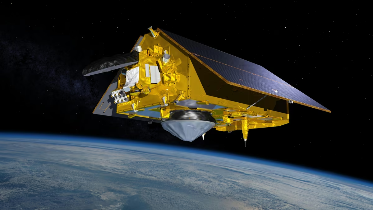
A satellite footprint is the area of Earth’s surface that is visible or serviceable from a spacecraft under defined geometric and technical conditions. Increasing altitude generally enlarges the geometric horizon and therefore the potential visibility footprint.
Actual coverage may be much smaller because of antenna beamwidth, minimum elevation angles, atmospheric conditions, sensor field of view, and spacecraft pointing restrictions.
Geostationary satellites can continuously observe a large portion of Earth’s visible hemisphere. In contrast, a LEO satellite typically moves rapidly over a smaller local footprint. Engineers use these differences to determine antenna architecture, imaging strategies, and constellation requirements. [1], [5]
3.5. How Do Satellites Achieve More Frequent Global Coverage?
A satellite constellation is a coordinated system of multiple spacecraft whose combined orbital positions provide better availability or coverage than a single satellite could deliver.
LEO broadband networks use multiple satellites and orbital planes to maintain connectivity as individual spacecraft pass over users. GPS similarly distributes navigation spacecraft across six orbital planes to provide global positioning signals.
Constellation design considers satellite count, orbital altitude, inclination, phasing, antenna coverage, and spacecraft availability. A larger constellation is not automatically better. Additional satellites also increase launch, network coordination, collision avoidance, maintenance, and replacement demands.
4. Why Does Orbital Altitude Affect Satellite Imaging and Earth Observation?
Earth observation satellites measure electromagnetic radiation coming from Earth’s surface, atmosphere, and oceans. Their instruments may detect reflected sunlight, emitted infrared radiation, or radar echoes generated by the spacecraft itself.
Orbital altitude influences viewing distance, possible image detail, geographic swath width, and observation timing. Nevertheless, altitude alone does not determine imaging quality. Sensor optics, wavelength selection, calibration, atmospheric conditions, and data processing are equally important to interpreting satellite observations.
4.1. How Do Earth Observation Satellites Collect Information?
Earth observation satellites carry instruments that detect energy from Earth’s environment and convert it into scientific measurements. Passive optical sensors record reflected solar radiation or naturally emitted thermal energy, while active instruments such as radar transmit energy and measure returning signals.
Different wavelength bands reveal different properties. Visible and near-infrared measurements help describe vegetation, while thermal infrared observations support surface temperature analysis.
Landsat and Sentinel-2 provide systematic land observations from LEO. Commercial high-resolution imaging platforms support more detailed local applications, while geostationary meteorological satellites repeatedly observe broad weather systems from much greater distances. [6], [7]
4.2. Why Does Satellite Altitude Affect Image Resolution?
Spatial resolution describes the scale of features an imaging system can distinguish. Ground Sampling Distance (GSD) describes the approximate ground spacing represented by image pixels.
For simplified near-nadir imaging geometry:
Where H is the sensor-to-ground distance, p is detector pixel pitch, and f is focal length.
If the optical system remains unchanged, increasing altitude generally increases ground sampling distance. However, GSD is not the same as effective spatial resolution. Diffraction, optical quality, motion, atmospheric effects, image processing, and signal-to-noise ratio can all limit actual detail.
As an example, Landsat 9 provides 30-meter multispectral imagery, with a 15-meter panchromatic band, from approximately 705 kilometers altitude. [6]
4.3. What Is Satellite Swath Width, and Why Does It Matter?
Swath width is the cross-track width of Earth’s surface observed during one acquisition. It influences how much territory an Earth observation satellite can cover on each pass.
For a simplified flat-surface, nadir-viewing sensor with angular field of view θ, the approximate swath width is:
This approximation becomes less accurate for wide viewing angles because Earth’s curvature must be considered.
Wide swaths support frequent regional or global coverage, while narrower imaging systems may prioritize finer spatial detail. Sentinel-2, for instance, combines a 290-kilometer swath with multispectral observations at several spatial resolutions. [7]
4.4. How Do Revisit Time and Temporal Resolution Affect Monitoring?
Revisit time is the interval between opportunities for a satellite or constellation to observe a particular location. Temporal resolution describes how frequently useful observations are available for studying changes over time.
These quantities depend on orbit geometry, swath width, latitude, off-nadir pointing, and the number of operational satellites. Clouds may prevent optical imagery from being useful even when the sensor passes over the target.
Landsat 8 and Landsat 9 each have a 16-day ground-track repeat cycle, but their coordinated observations provide approximately eight-day nominal coverage opportunities. Sentinel-2’s baseline paired-satellite configuration is designed for five-day equatorial revisit coverage. [6], [7]
4.5. How Do Spectral and Radiometric Resolution Improve Satellite Data?
Spectral resolution describes an instrument’s ability to distinguish electromagnetic wavelength intervals. Multispectral sensors record a defined set of bands, while hyperspectral instruments typically measure many narrower, closely spaced spectral channels.
These measurements help identify vegetation characteristics, water properties, minerals, and atmospheric constituents.
Radiometric resolution describes how finely the sensor digitizes differences in measured intensity. For example, a 12-bit digitization provides 4,096 possible digital levels, although this does not guarantee an equivalent number of scientifically distinguishable signal levels.
Unlike geometric sampling, spectral and radiometric performance depend strongly on instrument design, calibration, detector noise, and processing rather than altitude alone.
4.6. Optical Satellites vs. Synthetic Aperture Radar (SAR)
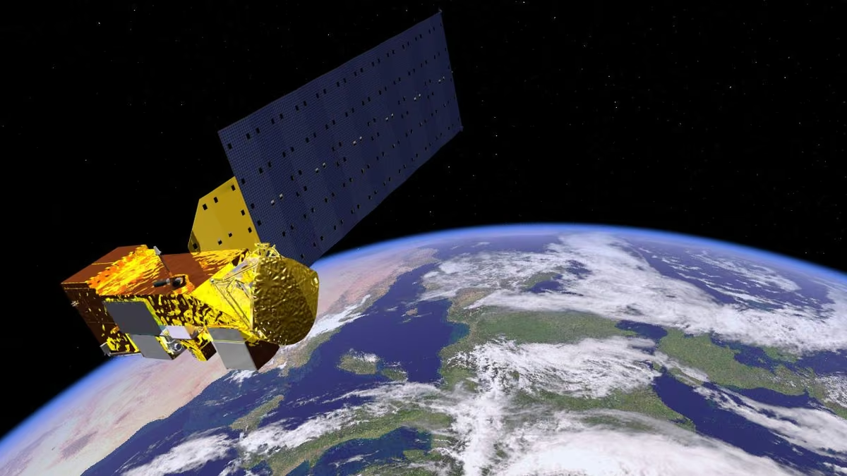
Optical satellites primarily use passive measurements of reflected sunlight, while Synthetic Aperture Radar satellites actively transmit microwave signals and analyze the returned echoes.
SAR can collect measurements at night and through many cloud conditions, making it particularly useful for flood mapping, maritime observation, ice monitoring, and surface deformation measurement. Certain heavy precipitation conditions and wavelengths can still affect radar observations.
Radar image quality depends on wavelength, bandwidth, antenna characteristics, acquisition geometry, platform motion, and signal processing. Sentinel-1 and RADARSAT missions demonstrate how SAR complements optical Earth observation rather than simply replacing it.
4.7. Which Altitudes Work Best for Different Earth Observation Missions?
Different observation tasks require different combinations of geographic coverage, spatial detail, and timing. High-resolution urban mapping usually favors relatively close observation distances, while continuous storm tracking favors the persistent regional visibility of GEO.
Environmental monitoring often uses sun-synchronous LEO because it supports repeated measurements under comparable illumination conditions.
| Observation objective | Common orbit | Important requirement | Main trade-off |
|---|---|---|---|
| Urban infrastructure | LEO | Fine spatial detail | Smaller coverage per acquisition |
| Agriculture | LEO / SSO | Spectral detail, regular revisits | Cloud interference |
| Forest monitoring | LEO / SSO | Consistent long-term imaging | Revisit and processing requirements |
| Flood mapping | LEO, often SAR | Timely observations | Satellite access and acquisition geometry |
| Global weather | GEO + polar LEO | Continuous plus detailed observations | Different coverage and resolution strengths |
| Ocean and climate studies | LEO / SSO | Calibrated, repeated measurements | Long-term consistency |
Orbit selection must be matched with the instrument and scientific data requirements, not just the desired viewing distance.
5. How Does Altitude Change Satellite Communication Performance?
Satellite communication systems transmit information between Earth stations, mobile terminals, and orbiting spacecraft. The altitude of a satellite affects signal propagation time, transmission power requirements, antenna geometry, connection continuity, and network architecture.
LEO systems can provide comparatively short communication paths but require satellites to move through the sky and transfer connections between spacecraft. GEO systems provide persistent regional visibility with stationary ground antennas, although their longer signal paths create greater communication delays and link-budget challenges.
5.1. Why Is Communication Latency Different in LEO, MEO, and GEO?
Communication latency is the time required for information to travel between network endpoints. One important component is propagation delay, which depends on the distance a signal travels.
Electromagnetic signals propagate through vacuum at approximately 299,792 kilometers per second. A simplified relationship is:
Where t represents propagation time, d represents path length, and c is the speed of light.
For a satellite directly overhead, the approximate one-way propagation delays for a single ground-to-satellite radio path are:
| Orbit example | Altitude | One-way vertical propagation delay |
|---|---|---|
| LEO | 550 km | 1.8 ms |
| MEO, GPS altitude | 20,200 km | 67.4 ms |
| GEO | 35,786 km | 119.4 ms |
These figures represent idealized propagation along one path segment. A ground-to-satellite-to-ground connection requires two such segments, and real paths are often slanted rather than vertical.
Round-trip internet latency includes additional transmissions, terrestrial routing, network processing, and congestion. Thus, real-world latency is not equal to the simple propagation figures shown above.
1.83 ms
67.38 ms
119.37 ms
5.2. What Is a Satellite Link Budget?
A satellite link budget is an engineering calculation that accounts for signal power, antenna gain, propagation losses, atmospheric attenuation, interference, receiver noise, and other factors affecting communication reliability.
One fundamental component is free-space path loss:
Here, d is propagation distance and λ is the signal wavelength. This is a linear power-loss ratio, which is often expressed in decibels.
Longer transmission paths produce greater free-space loss at a fixed frequency. Higher-frequency links may also experience significant rain attenuation, depending on the band and atmospheric conditions.
Engineers compensate through antenna gain, transmitter power, modulation techniques, error correction, receiver performance, and network design.
5.3. Why Does Line of Sight Matter for Satellite Connectivity?
Line of sight means that the communication path between a satellite and a receiving station is unobstructed by Earth’s surface or significant physical obstacles. Because Earth is curved, a low-altitude satellite eventually disappears below the horizon as it moves relative to the observer.
Buildings, trees, mountains, and other structures may further obstruct signals. Ground antennas commonly require minimum elevation angles to maintain suitable performance and reduce interference or atmospheric attenuation.
GEO satellites appear in nearly fixed sky positions, making permanent antenna alignment practical. However, their apparent elevation decreases at many high-latitude locations, which may create difficult or impossible viewing geometry.
5.4. How Do Ground Stations Communicate With Satellites?
A ground station is a terrestrial facility equipped to exchange radio or optical signals with spacecraft. Ground infrastructure supports telemetry reception, orbital tracking, command transmission, and downloading scientific or commercial data.
Telemetry provides information about spacecraft health, while tracking observations assist orbit determination. Command links allow operators to change spacecraft settings, schedule observations, and perform maneuvers.
For a LEO satellite, communication with an individual ground station typically occurs during relatively short visibility windows. GEO satellites, in contrast, may remain accessible continuously from appropriately positioned stations.
Networks such as ESA’s Estrack distribute antennas across multiple locations to improve communications opportunities and mission coverage.
5.5. Why Does Satellite Handover Matter for LEO Internet?
Satellite handover occurs when an active communication session transfers between satellites, beams, gateways, or related network resources.
LEO satellites move rapidly relative to a fixed user. Consequently, a terminal may communicate through several satellites during a continuous internet session. The network must manage these transitions without excessive packet loss or service interruption.
Systems such as Starlink and OneWeb rely on coordinated constellation operations, satellite tracking, beam management, and network routing.
GEO satellite systems generally require fewer satellite-to-satellite handovers for stationary terminals. Nevertheless, their network architecture may still include terrestrial gateway switching, beam management, or other service transitions.
5.6. How Do Inter-Satellite Links Improve Satellite Networks?
An Inter-Satellite Link (ISL) is a direct communication connection between two spacecraft. These links allow satellites to exchange information without routing every transmission immediately through an Earth station.
ISLs may use radio frequencies or optical communication systems. Optical links can support high data rates with narrow beams but require precise pointing and tracking.
In a networked constellation, inter-satellite connections can extend data-routing options, reduce dependence on nearby gateways, and improve connectivity across oceans or remote regions.
However, the arrangement of satellite links changes as spacecraft move. Operators must account for changing distances, relative motion, network topology, pointing constraints, and route availability.
5.7. Why Does Doppler Shift Affect Satellite Signals?
Doppler shift is the change in received signal frequency caused by relative motion between a transmitter and receiver. The effect becomes particularly important when LEO spacecraft approach and recede from ground stations at high relative speeds.
For nonrelativistic motion, a useful approximation for the magnitude of the frequency change is:
Here, vr is relative radial velocity, f0 is transmitted frequency, and c is the speed of light.
Receivers use frequency tracking and compensation to maintain reliable communications. Doppler measurements can also support spacecraft tracking and velocity estimation.
Even high-altitude satellite links may require frequency compensation, although an ideally geostationary satellite has minimal relative radial motion to a stationary ground terminal.
5.8. Why Do Satellite Broadband Systems Use Different Orbital Altitudes?
Satellite broadband systems provide internet access using space-based communication infrastructure. Different altitudes lead to different network architectures rather than simply producing a faster or slower version of the same system.
LEO satellites offer lower propagation delays and relatively short radio paths. However, global or near-global continuous service requires numerous spacecraft, multiple orbital planes, sophisticated handover management, and substantial ground infrastructure.
GEO satellites can serve large regions from a comparatively small number of spacecraft, supporting applications where continuous wide-area visibility is valuable.
Actual broadband performance depends on allocated spectrum, network capacity, user density, gateway locations, antenna capability, atmospheric conditions, and network management. Orbit altitude is important, but it is only one component of overall service quality.
6. Why Are Navigation Satellites Commonly Placed in Medium Earth Orbit?
Navigation satellites help users determine position, velocity, and precise time by transmitting carefully synchronized radio signals. Unlike broadband networks, their primary purpose is not transferring large volumes of user data. They provide timing and orbital information that enables receivers to calculate distances to multiple satellites.
Medium Earth Orbit offers useful geographical coverage and constellation geometry with manageable satellite numbers. However, navigation performance also depends on accurate clocks, orbital predictions, signal propagation models, receiver design, and interference conditions.
6.1. How Does Satellite Navigation Work?
A Global Navigation Satellite System (GNSS) uses spacecraft transmitting precise timing information and orbital data. A receiver estimates how long signals take to arrive and converts those travel times into apparent distances called pseudoranges.
Using measurements from multiple satellites, the receiver solves for its three-dimensional position and its clock offset. In ordinary standalone GNSS positioning, at least four suitable satellite measurements are typically needed to solve these four unknowns.
GPS, Galileo, GLONASS, and BeiDou are major GNSS systems. Their services support navigation, surveying, transportation, telecommunications synchronization, financial infrastructure, and scientific measurements.
Because radio signals travel extremely quickly, even small timing errors can produce significant ranging errors. [3], [4]
6.2. Why Do GPS and Galileo Use MEO?
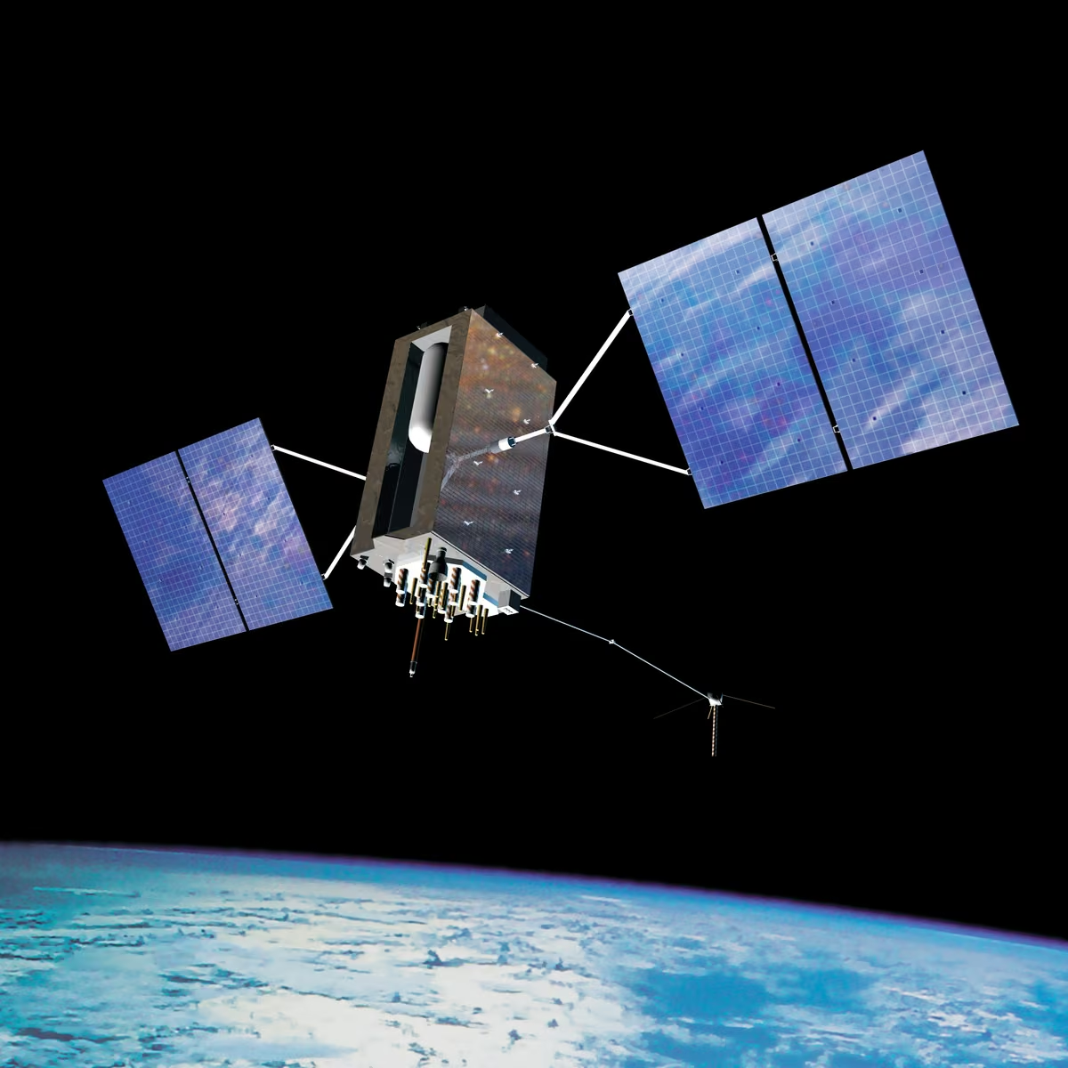
GPS satellites operate approximately 20,200 kilometers above Earth, while Galileo’s nominal orbital altitude is approximately 23,222 kilometers.
These altitudes provide broad satellite visibility while allowing distributed constellations to serve users across much of the planet. GPS uses six principal orbital planes with a nominal inclination of 55 degrees, while Galileo’s baseline design uses three planes at approximately 56 degrees inclination.
MEO creates a practical balance among coverage, orbital predictability, constellation complexity, and signal availability. It is not chosen primarily to minimize latency.
Accurate timing, stable orbital geometry, radiation resistance, and a sufficient number of visible satellites matter much more for navigation than achieving the lowest possible communication delay. [3], [4]
6.3. What Is the Difference Between GPS, Galileo, GLONASS, and BeiDou?
These systems share the basic principle of satellite-based positioning but use different constellation architectures, signals, frequencies, ground-control infrastructures, and service designs.
| GNSS | Operating organization | General orbital architecture |
|---|---|---|
| GPS | United States | MEO constellation |
| Galileo | European Union | MEO constellation |
| GLONASS | Russia | MEO constellation |
| BeiDou | China | MEO, GEO, and inclined geosynchronous satellites |
BeiDou’s combination of different orbital regimes supports its particular service architecture. The exact number of active spacecraft in each system changes as satellites are launched, repositioned, retired, or replaced.
Modern multi-constellation receivers can process signals from several systems, potentially improving availability and geometric diversity, particularly in challenging environments.
6.4. How Does Orbit Selection Influence Navigation Accuracy?
Navigation accuracy depends partly on the geometric distribution of satellites in the receiver’s sky. When visible satellites occupy favorable directions, measurement errors generally have less influence on the estimated position.
This relationship is described using dilution of precision, or DOP. Poor geometry can amplify errors even when the individual satellite signals are relatively accurate.
Other significant error sources include imperfect satellite clocks, orbital prediction uncertainties, ionospheric and tropospheric propagation delays, signal reflections, interference, and receiver limitations.
High-precision navigation may use multi-frequency measurements, augmentation systems, differential corrections, or precise point positioning techniques. Orbital altitude influences constellation geometry and signal strength, but it does not independently determine positioning accuracy.
7. How Do Spacecraft Change Altitude and Transfer Between Orbits?
A satellite does not normally change orbital altitude simply by pointing its engines upward and climbing. Orbital transfers involve changing the spacecraft’s energy and angular momentum through carefully timed maneuvers.
A prograde burn generally increases orbital energy, while a retrograde burn reduces it. The resulting trajectory depends on where the maneuver takes place and how the thrust is directed. Propulsion strategy therefore affects spacecraft mass, mission cost, transfer duration, and operational lifetime.
7.1. What Is Orbital Energy?
Orbital mechanical energy is the sum of a spacecraft’s kinetic energy and gravitational potential energy. For an ideal two-body orbit, specific orbital energy can be written as:
For a bound elliptical orbit:
Here, a represents the orbital semimajor axis.
A satellite in a higher circular orbit has greater total mechanical energy, even though its final circular orbital speed is lower.
This result can appear counterintuitive. To raise a satellite into a higher circular orbit, propulsion must add energy during the transfer, while the spacecraft’s eventual equilibrium orbital speed becomes smaller.
7.2. What Is Delta-v, and Why Is It Important?
Delta-v, commonly written Δ v, describes the change in velocity associated with a propulsion maneuver. Mission designers also use total delta-v budgets to estimate the cumulative maneuvering capability required throughout a mission.
A spacecraft may need delta-v for orbital insertion, altitude changes, inclination corrections, collision avoidance, station-keeping, and end-of-life disposal.
The rocket equation relates achievable delta-v to effective exhaust velocity and spacecraft mass ratio:
Where ve is effective exhaust velocity, m0 is initial mass, and mf is final mass.
A satellite’s delta-v budget is not its orbital speed. It represents the propulsion capability available to modify its trajectory.
7.3. How Does an Orbital Transfer Work?
An orbital transfer changes a spacecraft from one orbit to another through one or more propulsion maneuvers. In an ideal impulsive maneuver, thrust produces an approximately instantaneous change in velocity, although real propulsion burns require finite time.
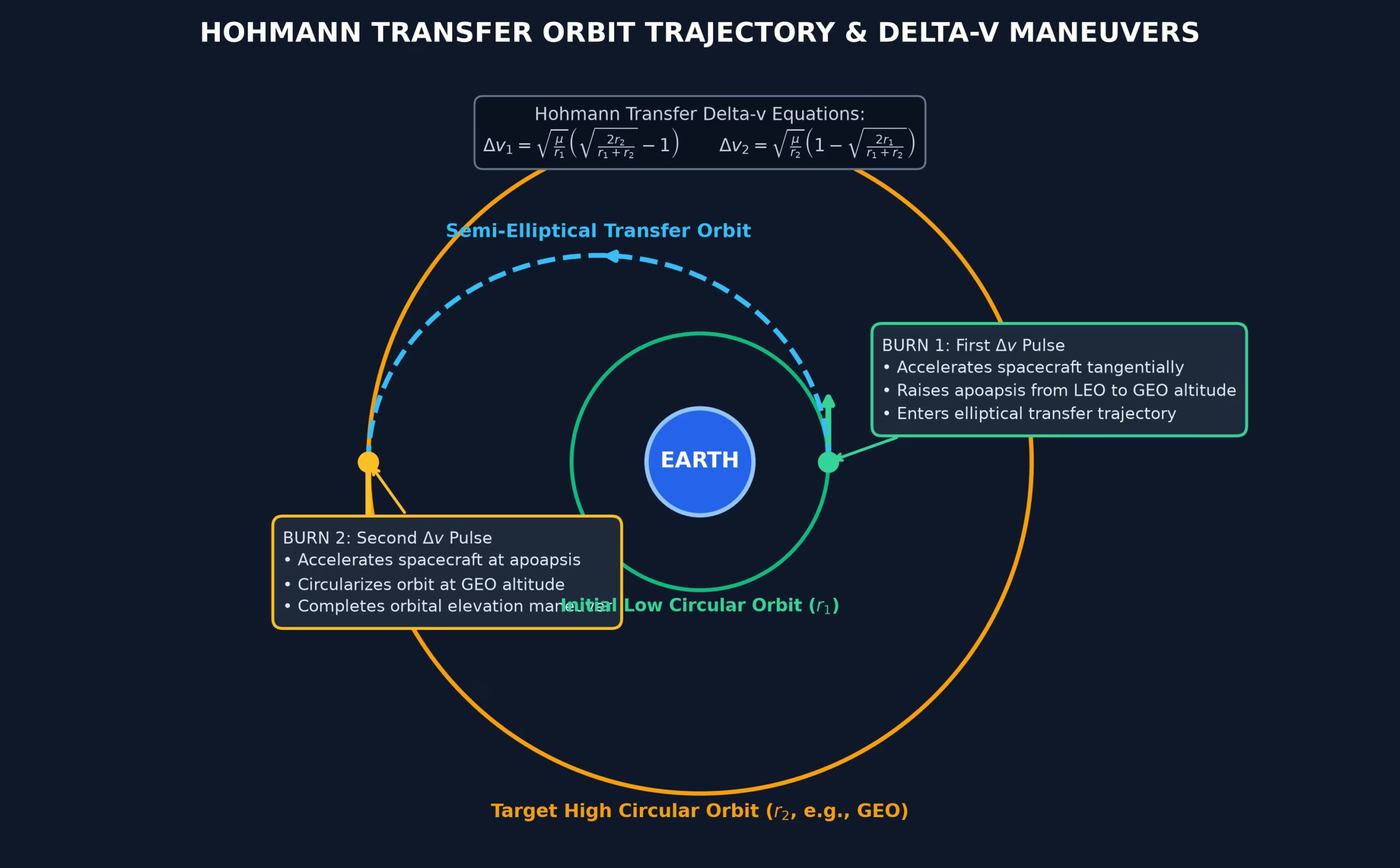
A prograde burn in a circular orbit initially raises the opposite side of the orbit, creating an elliptical trajectory with a higher apogee. Another properly timed burn can then circularize the orbit.
Retrograde burns reduce orbital energy and can lower the opposite side of the trajectory.
Engineers choose burn locations based on the desired change in energy, eccentricity, orbital plane, or argument of perigee. Multiple-burn transfers are common because they can reduce required propellant or satisfy operational constraints.
7.4. What Is a Hohmann Transfer Orbit?
A Hohmann transfer is an idealized orbital maneuver connecting two coplanar circular orbits through an intermediate elliptical trajectory.
The first impulsive burn changes the spacecraft from its original circular path to the transfer ellipse. After traveling along that ellipse, the spacecraft performs a second burn to enter the destination circular orbit.
For many ideal coplanar transfers, this arrangement offers an efficient propellant solution compared with alternative two-impulse transfers.
However, it does not always provide the fastest transfer, and it is not universally optimal for every orbital radius ratio or mission constraint. Inclination changes, low-thrust propulsion, atmospheric drag, and operational requirements can favor other trajectories.
7.5. Why Are Satellites Launched into Geostationary Transfer Orbit (GTO)?
A Geostationary Transfer Orbit is typically an elliptical orbit with an apogee close to geostationary altitude. Launching a spacecraft into GTO allows the launch vehicle and satellite propulsion system to share the work of reaching the final geostationary operating orbit.
The spacecraft subsequently performs maneuvers to raise its perigee, adjust inclination, and enter the desired geostationary slot.
This process can reduce some launch vehicle requirements compared with direct insertion into GEO. However, the satellite must carry appropriate propulsion capability or receive orbital-raising assistance.
Electric-propulsion spacecraft may perform relatively gradual transfers rather than relying exclusively on short, high-thrust burns.
7.6. How Do Satellite Propulsion Systems Support Orbital Missions?
Satellite propulsion systems create controlled forces that modify spacecraft trajectories or, in some designs, contribute to attitude management.
Chemical propulsion produces comparatively high thrust and is useful for rapid maneuvers. Electric propulsion generally provides much lower thrust but can achieve high effective exhaust velocities, allowing efficient use of propellant over long operating periods.
Different missions require different propulsion capabilities. LEO spacecraft may need drag compensation, collision avoidance, and disposal maneuvers. GEO satellites may require longitude and inclination station-keeping over many years.
Propulsion reliability, maneuver duration, electrical power requirements, and available propellant all influence the useful lifetime of a satellite.
7.7. How Does Launch Vehicle Performance Influence Orbit Selection?
Launch vehicle performance determines the spacecraft mass that can be delivered to a specified orbit under defined mission conditions.
Reaching an orbit with greater required launch energy generally reduces payload capability for a particular launch vehicle. Orbital inclination, launch-site latitude, staging, aerodynamic conditions, and mission-specific insertion requirements also influence performance.
Rockets such as Falcon 9 and Ariane 6 can serve different orbital missions, but payload capacity depends on the exact trajectory and operational configuration.
For example, launching a payload into a relatively low-inclination orbit from a favorable site may allow greater use of Earth’s rotational velocity than launching into a high-inclination or polar orbit.
Engineers therefore evaluate orbit selection alongside launch cost and vehicle capability.
7.8. What Is Escape Velocity, and How Is It Different from Orbital Velocity?
Escape velocity is the minimum speed needed at a given distance from a celestial body to escape its gravitational field without additional propulsion, assuming ideal conditions and no atmospheric resistance.
The local escape speed is:
For the same radius, circular orbital velocity is:
Therefore:
At Earth’s surface, the ideal escape speed is approximately 11.2 kilometers per second.
A satellite does not need escape velocity to reach a higher Earth orbit. Orbit raising can occur while the spacecraft remains gravitationally bound. Escape trajectories are associated with sufficient energy to depart Earth without returning in an ordinary bound orbit.
8. What Forces and Environmental Conditions Affect Satellites at Different Altitudes?
Space is not an environment free from forces or hazards. Even after a spacecraft reaches its target orbit, atmospheric particles, Earth’s uneven gravity field, sunlight, radiation, and gravitational influences from the Moon and Sun can alter its motion or affect its equipment.
These influences vary considerably with altitude and orbital geometry. Some create operational problems, while others can be deliberately exploited, as demonstrated by sun-synchronous orbit design.
8.1. What Is Atmospheric Drag, and Why Is It Strongest in Lower Orbits?
Atmospheric drag is the resistance caused by particles in Earth’s upper atmosphere interacting with a spacecraft moving at orbital speed. Earth’s atmosphere does not end at a sharp boundary. Instead, its density generally decreases with increasing altitude.
Although the atmosphere is extremely thin at typical LEO altitudes, satellites move fast enough for drag to affect their trajectories over time.
Drag depends on atmospheric density, spacecraft velocity relative to the atmosphere, projected area, drag coefficient, and mass. Solar and geomagnetic activity can heat and expand the upper atmosphere, increasing density at a given altitude.
Atmospheric drag is a major consideration in lower LEO and generally negligible for ordinary GEO operations.
8.2. What Causes Orbital Decay?
Orbital decay is the gradual loss of orbital energy that can cause a satellite’s altitude to decrease. In low Earth orbit, atmospheric drag is a major cause.
As a spacecraft loses energy, its orbit may shrink. At lower altitudes, atmospheric density generally increases, potentially accelerating subsequent decay.
Satellites operating in regions with significant drag may require occasional orbit-raising maneuvers. The ISS, for example, undergoes reboosts to maintain a suitable operating altitude.
If orbital decay continues without sufficient propulsion to counteract it, the spacecraft eventually encounters denser atmospheric layers and reenters. The time required depends strongly on altitude, atmospheric conditions, spacecraft area-to-mass ratio, and other factors.
8.3. What Are Orbital Perturbations?
Orbital perturbations are changes in spacecraft motion caused by forces beyond the simplest two-body gravitational model.
Important perturbations include Earth’s nonspherical gravity field, atmospheric drag, the gravitational attraction of the Moon and Sun, and solar radiation pressure.
Their relative importance varies by orbit. Atmospheric drag strongly influences many low-altitude spacecraft, while lunisolar gravity and solar radiation pressure are important considerations for high-altitude missions.
Accurate mission planning requires orbit propagation models that account for relevant perturbations over the intended operational period.
Ignoring these effects can lead to incorrect predictions of ground tracks, spacecraft positions, orbital element changes, and collision risks.
8.4. What Is the J2 Perturbation?
The J2 perturbation is the dominant correction associated with Earth’s equatorial bulge in a spherical-harmonic representation of its gravity field.
Earth is not a perfect sphere. Its equatorial radius is larger than its polar radius, and its mass distribution produces gravitational effects that differ from those of an ideal spherical body.
J2 causes long-term changes in orbital elements, particularly the longitude of the ascending node and argument of perigee.
Rather than always treating this as an unwanted disturbance, engineers can choose orbit parameters that use predictable J2-driven changes to maintain desired orbital geometry, including sun-synchronous motion.
8.5. How Does Nodal Precession Help Maintain Sun-Synchronous Orbits?
Nodal precession is the gradual rotation of an orbit’s line of nodes, which is the intersection of the orbital plane with Earth’s equatorial plane.
For a properly designed sun-synchronous orbit, J2-induced nodal precession approximately matches Earth’s mean orbital motion around the Sun, about one degree per day.
This helps preserve nearly constant local solar time for repeated passes over a location.
The precession rate depends on inclination, semimajor axis, eccentricity, and Earth’s gravity field. Designers therefore select these parameters together.
A sun-synchronous orbit is maintained largely through natural gravitational behavior, although real spacecraft may still require periodic corrections.
8.6. How Do Earth’s Radiation Belts Affect Satellites?
Earth’s Van Allen radiation belts contain energetic charged particles trapped by Earth’s magnetic field. Their spatial distribution and intensity vary with particle energy, geomagnetic conditions, and time.
Satellites passing through or operating in regions of significant radiation exposure can experience electronic upsets, accumulated radiation damage, sensor degradation, and reduced solar-array performance.
Many MEO missions, including navigation spacecraft, must be designed for substantial long-term radiation exposure.
Engineers use radiation-tolerant components, shielding, fault detection, error correction, and appropriate mission planning to manage these risks.
Radiation conditions cannot be determined from altitude alone because the magnetic environment and spacecraft trajectory also influence the exposure experienced by individual components.
9. How Does Orbit Selection Affect Satellite Maintenance and Operational Lifetime?
A satellite’s operational lifetime is determined by its ability to continue performing its mission reliably. This depends on equipment health, available propulsion resources, environmental exposure, communication capability, and the condition of its onboard power systems.
Altitude influences several of these factors, but operating farther from Earth does not automatically mean a satellite will last longer. A successful mission requires a balance between environmental conditions, orbital maintenance requirements, spacecraft reliability, and end-of-life planning.
9.1. What Determines Satellite Operational Lifetime?
Satellite operational lifetime is the period during which a spacecraft can perform its intended mission within acceptable technical and performance limits.
Important factors include component reliability, battery degradation, solar-array performance, radiation damage, propellant availability, thermal cycling, and the spacecraft’s ability to maintain a suitable orbit and orientation.
In low Earth orbit, atmospheric drag can consume propulsion resources or eventually cause uncontrolled orbital decay. Higher-altitude spacecraft may experience less drag but must address other challenges, including radiation and long-term orbital perturbations.
Design lifetime also differs from actual operational lifetime. Landsat 9, for example, reached its five-year design-life milestone on September 27, 2026, illustrating how spacecraft may remain useful after completing their original design-life objectives. [10]
9.2. Why Do Satellites Need Station-Keeping?
Station-keeping consists of corrective maneuvers used to maintain a satellite within an acceptable orbital region or relative position.
LEO spacecraft may perform maneuvers to compensate for atmospheric drag or preserve required ground-track conditions. GEO satellites typically require east-west and north-south station-keeping to maintain assigned orbital positions and manage inclination changes.
Station-keeping consumes propulsion capability and can influence mission lifetime. The necessary frequency and magnitude depend on orbit characteristics, spacecraft design, environmental forces, and mission tolerances.
Some missions intentionally allow natural orbital drift when exact position control is unnecessary, reducing propulsion requirements at the expense of stricter geographic or timing consistency.
9.3. How Do Satellites Maintain Reliable Mission Operations?
Reliable satellite operations require continuous or scheduled assessment of spacecraft condition, orbital position, communications performance, and mission data quality.
Ground controllers and automated onboard systems monitor telemetry, power generation, battery state, temperatures, attitude-control performance, and equipment faults. Orbit determination and tracking systems help predict future positions and evaluate potential conjunctions with other space objects.
Redundant systems can allow spacecraft to continue operating after individual components fail.
Large constellations introduce additional coordination requirements because operators must manage numerous spacecraft, orbital planes, software configurations, communication resources, and collision-avoidance decisions simultaneously.
Modern satellite operations increasingly combine ground-based planning with onboard automation and fault recovery.
10. Why Are Space Debris and Satellite Collisions Major Concerns?
The space surrounding Earth contains active satellites, defunct spacecraft, discarded rocket components, and debris fragments produced by previous missions and collisions. Objects moving at orbital velocities can cause severe damage even when they are relatively small.
The consequences depend on collision speed, object mass, trajectory, and spacecraft vulnerability. Altitude plays an important role because it influences debris persistence, traffic concentration, atmospheric removal, and the strategies available for safe satellite disposal.
10.1. What Is Space Debris?
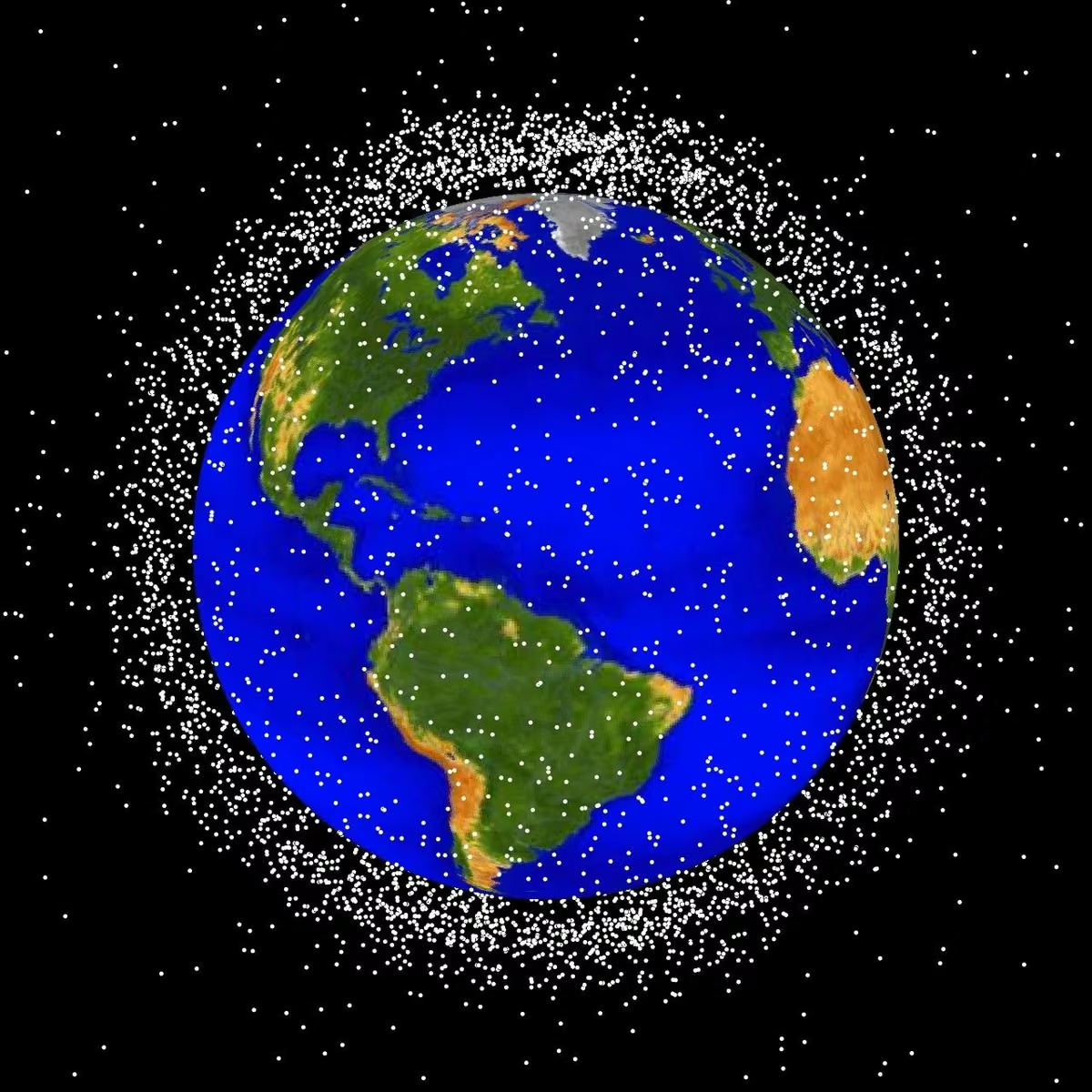
Space debris consists of human-made objects in space that no longer serve a useful function. Examples include inactive satellites, rocket bodies, fragmentation debris, and components released during missions.
Even small pieces can threaten operational spacecraft because relative collision velocities may reach several kilometers per second.
Space surveillance systems track many objects and use their predicted orbital trajectories to assess potential close approaches. However, the smallest debris objects are difficult or impossible to track individually.
Debris risk depends on more than total object count. Orbital inclination, altitude distribution, relative velocity, object size, spacecraft cross-sectional area, and time spent in a region also influence collision probability.
10.2. Why Is Space Debris Especially Concerning in LEO?
LEO contains numerous active spacecraft and debris objects, creating significant demands for orbital tracking and collision avoidance.
The persistence of debris depends strongly on altitude. At sufficiently low altitudes, atmospheric drag causes many objects to reenter over relatively short periods. At higher LEO altitudes, atmospheric density is lower and debris may remain in orbit for decades or longer, depending on conditions.
This creates an important distinction between orbital congestion and debris persistence. A region with many spacecraft may experience significant conjunction-management demands, while a region with persistent fragments can pose long-term risks even without high levels of current activity.
Responsible constellation design must account for both effects. [8], [9]
10.3. What Is Kessler Syndrome?
Kessler Syndrome describes a potential process in which collisions between orbiting objects generate debris that increases the probability of further collisions.
The concept is associated with research by Donald J. Kessler and colleagues on the long-term growth of Earth’s orbital debris environment.
If a region accumulates sufficient debris, collisions may contribute to a self-sustaining growth in the debris population, even without additional launches.
This does not imply that all satellites would suddenly collide in an immediate chain reaction. It describes a potentially progressive, long-term environmental instability affecting particular orbital regions.
Preventing debris generation and reducing the time inactive spacecraft remain in useful orbits are important mitigation strategies.
10.4. How Do Collision Avoidance Maneuvers Work?
Collision avoidance begins with orbital tracking and the prediction of close approaches, commonly called conjunctions. Operators assess the predicted separation between objects, uncertainties in their positions, and the probability of collision.
When the assessed risk exceeds an operator’s decision threshold, a maneuver may be considered.
A relatively small change in spacecraft velocity, performed sufficiently early, can alter the future orbital trajectory enough to increase separation at the predicted encounter.
Maneuver planning must consider available propulsion capability, mission disruption, tracking uncertainty, and potential effects on other conjunctions.
Coordination becomes increasingly important when two maneuverable satellites are approaching one another and both operators might independently adjust their trajectories.
10.5. What Happens When Satellites Reach the End of Their Missions?
End-of-life disposal depends on a spacecraft’s orbit, design, propulsion capability, and applicable regulatory requirements.
LEO satellites may be deliberately deorbited to reenter Earth’s atmosphere. Controlled reentry can reduce risks to people and property by directing surviving debris toward selected areas, while other spacecraft may undergo uncontrolled reentry according to approved mission plans.
Retired GEO spacecraft are commonly moved into disposal or graveyard orbits above the operational geostationary region.
Regulations vary among jurisdictions and missions. In the United States, the Federal Communications Commission adopted a five-year post-mission disposal requirement for certain satellites operating in or passing through LEO, while ESA introduced stricter debris-mitigation requirements for its missions in November 2023. [8], [9]
11. How Does Altitude Determine the Best Orbit for Each Satellite Mission?
Selecting a satellite orbit is a systems-engineering problem. Engineers must match orbital parameters to the spacecraft’s payload, its users, and the environment in which it will operate.
The same satellite altitude may be excellent for one mission and unsuitable for another. Navigation requires broad signal availability and precise timing. Earth imaging requires carefully controlled observation geometry. Weather forecasting benefits from both persistent regional views and detailed global measurements.
11.1. Which Orbits Are Best for Weather Satellites?
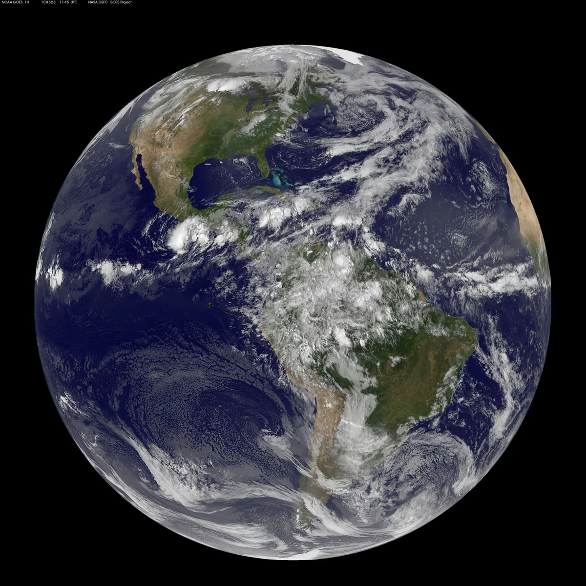
Weather satellites commonly use geostationary and near-polar sun-synchronous orbits because these provide complementary observation capabilities.
Geostationary satellites, including NOAA’s GOES series and Europe’s Meteosat systems, repeatedly observe broad geographic regions. They are particularly useful for monitoring cloud development, atmospheric motion, and rapidly evolving severe weather.
Polar-orbiting weather satellites provide global measurements, often with instruments suited to atmospheric temperature, humidity, and environmental sounding.
NOAA’s Joint Polar Satellite System operates at approximately 824 kilometers altitude, with spacecraft completing about 14 orbits daily.
Forecasting systems integrate measurements from multiple orbital perspectives because neither GEO nor polar LEO alone provides every type of observation required. [5], [11]
11.2. Which Orbits Are Best for Communication Satellites?
The best communication orbit depends on acceptable latency, geographic coverage, ground equipment, capacity requirements, and operating cost.
Geostationary satellites are effective for continuous regional communication services, television distribution, and applications involving fixed ground antennas.
LEO satellites are attractive for services requiring lower propagation delays, although continuous connectivity generally requires a distributed constellation and frequent handovers.
MEO communications networks offer another architectural option by balancing broader footprints against longer signal paths than LEO.
Engineers must also consider radio spectrum, power requirements, user-terminal design, and gateway infrastructure. An orbit with favorable propagation delay will not necessarily deliver the highest throughput if its network has insufficient capacity.
11.3. Which Orbits Are Best for Scientific and Research Satellites?
Scientific missions require orbits that support their experimental objectives, observation geometry, and payload performance.
The ISS operates in LEO because this provides a practical environment for crewed research, logistics, orbital access, and experiments involving microgravity. Many Earth science missions also operate in LEO to observe Earth’s environment at relatively close range.
Other scientific missions require more specialized trajectories. Space telescopes may benefit from locations far beyond conventional Earth orbit, while magnetospheric research spacecraft may use elliptical orbits designed to sample different regions of Earth’s space environment.
Mission designers must evaluate observation requirements alongside launch capability, radiation exposure, communication distance, thermal stability, and spacecraft lifetime.
11.4. Which Orbits Are Best for Mapping and Environmental Monitoring?
Mapping and environmental monitoring frequently use sun-synchronous LEO trajectories. These provide repeatable viewing geometry and approximately consistent illumination conditions that support long-term comparisons.
Landsat 9 operates at approximately 705 kilometers, while Sentinel-2 uses a nominal altitude near 786 kilometers.
The choice between different imaging systems depends on spatial resolution, spectral capabilities, swath width, revisit frequency, and continuity of archived measurements.
Urban mapping may require finer image detail, while vegetation and climate monitoring often place greater emphasis on calibrated multispectral measurements collected consistently over many years.
Optical systems and SAR missions can also be combined to improve observation opportunities in cloudy regions. [6], [7]
11.5. Which Orbits Are Best for Global Navigation?
Global navigation systems commonly use MEO because this altitude range supports broad geographical visibility with manageable constellation sizes.
GPS and Galileo demonstrate this architecture, using satellites distributed across carefully arranged orbital planes.
A navigation receiver benefits from observing multiple spacecraft occupying different positions in the sky. The distribution of those spacecraft contributes directly to positioning geometry and service availability.
Not all navigation architectures rely exclusively on MEO. BeiDou uses a combination of MEO, geostationary, and inclined geosynchronous satellites to support its system design.
Reliable navigation requires accurate orbital predictions, stable onboard clocks, continuous monitoring, and carefully controlled signal characteristics. [3], [4]
11.6. How Do Engineers Choose the Right Satellite Altitude?
Orbit selection should begin with mission requirements, not with a preferred altitude. Engineers establish what the spacecraft must accomplish and evaluate candidate trajectories against technical, operational, and financial constraints.
A practical decision process includes:
- Mission definition: Identify scientific, commercial, communication, or navigation objectives.
- Geographic coverage: Determine the regions that must be observed or served.
- Performance requirements: Establish acceptable latency, imaging detail, signal quality, or navigation accuracy.
- Temporal requirements: Define revisit intervals or continuous coverage needs.
- Environmental assessment: Evaluate atmospheric drag, radiation, thermal behavior, and debris exposure.
- Spacecraft design: Assess power, propulsion, payload mass, and communication capabilities.
- Launch analysis: Determine accessible trajectories and launch vehicle requirements.
- Operational planning: Estimate maintenance demands, mission lifetime, and constellation complexity.
- Disposal strategy: Ensure the orbit supports responsible end-of-life management.
Altitude must be considered alongside inclination, eccentricity, orbital phasing, and payload characteristics.
Mission-to-Orbit Selection Comparison
| Mission requirement | Common candidate orbit | Main advantage | Key limitation |
|---|---|---|---|
| High-detail Earth imaging | LEO / SSO | Favorable observation distance | Limited instantaneous coverage |
| Low-latency internet | LEO | Shorter propagation paths | Many satellites and handovers |
| Global navigation | MEO | Broad visibility and constellation geometry | Radiation and timing requirements |
| Regional weather monitoring | GEO | Continuous regional observation | Limited polar visibility |
| High-latitude communications | HEO | Long dwell over selected regions | Varying distance and tracking |
| Television broadcasting | GEO | Fixed apparent satellite position | Greater signal delay |
| Crewed orbital research | LEO | Practical logistics and access | Drag and debris exposure |
This comparison illustrates why the mission’s requirements must determine orbit selection rather than treating one orbital regime as universally superior.
12. Future Challenges: How Will Orbital Altitude Shape the Next Generation of Satellite Missions?
The expansion of commercial constellations, increasing demand for Earth observation, and improvements in onboard computing and propulsion are changing how orbital infrastructure is designed and operated.
However, the underlying physics remains unchanged. Higher altitude still increases communication distance, lower altitude still exposes spacecraft to more atmospheric drag, and orbital geometry still determines access and coverage.
The key engineering challenge is to improve mission capabilities without creating unsustainable congestion or excessive operational complexity.
12.1. Can LEO Support Increasing Numbers of Satellites?
LEO can support large satellite constellations, but increasing spacecraft populations place greater demands on coordination, tracking, and responsible disposal.
The number of spacecraft is not the only important parameter. Orbit altitude, inclination, traffic distribution, relative velocities, and maneuvering capability also affect the risk environment.
Operators need reliable orbital predictions, coordinated collision avoidance, secure command systems, and methods for safely retiring spacecraft.
Launching satellites into lower orbital regions may support faster natural atmospheric removal after retirement, but this must be balanced against drag compensation and mission requirements.
Long-term sustainability depends on operators preventing fragmentation events and avoiding unnecessary accumulation of inactive spacecraft.
12.2. Will Better Propulsion and Satellite Networking Change Orbit Selection?
Advances in spacecraft technology can alter the engineering trade-offs associated with different orbital regimes.
Electric propulsion may allow efficient orbit raising, station-keeping, and disposal using relatively small quantities of propellant, although maneuver duration and electrical power remain important considerations.
Improved optical inter-satellite links can support more flexible network routing, while onboard autonomy may help spacecraft manage communication, navigation, and collision avoidance with reduced dependence on immediate ground intervention.
Higher-performance sensors may also enable useful imagery from a wider selection of observation altitudes.
These improvements expand mission design options, but they do not eliminate physical constraints involving gravity, communication delay, field of view, energy requirements, or radiation exposure.
12.3. Why Is Long-Term Orbital Sustainability Important?
Orbital sustainability means preserving the ability to use space safely and reliably over the long term.
Debris accumulation, uncontrolled spacecraft failures, and poorly coordinated maneuvers can create hazards that persist beyond an individual satellite’s operational life.
Space sustainability therefore requires cooperation among manufacturers, operators, launch providers, regulators, and international organizations.
ESA’s Zero Debris approach and evolving debris-mitigation regulations illustrate growing efforts to reduce the creation and persistence of orbital debris. These initiatives address disposal planning, collision prevention, spacecraft reliability, and end-of-life operations.
Sustainable orbital infrastructure protects scientific research, weather forecasting, navigation, communications, and future exploration activities. [8], [9]
13. Frequently Asked Questions About Satellites and Orbital Altitude
Satellite altitude influences orbital speed, period, coverage, and mission performance, but several common questions require additional clarification. In particular, altitude is often confused with total orbital radius, and geostationary motion is sometimes incorrectly described as a satellite standing still in space.
The following answers summarize important distinctions and connect basic orbital physics to practical satellite mission design.
13.1. Why Do Satellites Orbit at Different Altitudes?
Satellites orbit at different altitudes because different missions require different combinations of geographical coverage, observation detail, communication delay, orbital lifetime, and operational cost.
A low-altitude satellite can observe Earth from a closer distance and provide relatively short communication paths. A high-altitude satellite can see a wider region, although it experiences greater signal propagation delay.
GPS satellites use MEO to support global navigation, while GEO weather satellites provide persistent regional observations. Engineers select altitude together with inclination, eccentricity, spacecraft equipment, and constellation architecture.
13.2. Do Higher Satellites Orbit Faster or Slower?
For ideal circular orbits around Earth, higher satellites move more slowly than lower satellites.
The circular orbital velocity relationship is v=\sqrt{μ/r}, where r is distance from Earth’s center.
As orbital radius increases, circular speed decreases. However, this rule should not be applied indiscriminately to different points on an elliptical trajectory. Within one elliptical orbit, a satellite moves faster near perigee and slower near apogee.
The complete relationship between altitude and velocity therefore depends on both orbital energy and orbital shape.
13.3. Why Do Lower Satellites Complete an Orbit Faster?
Lower satellites complete circular orbits faster because they follow smaller orbital paths while moving at higher orbital speeds.
Kepler’s Third Law relates a satellite’s orbital period to its semimajor axis. For ideal Earth-centered orbits, the period increases as the orbital size increases.
A spacecraft at a few hundred kilometers altitude typically completes an orbit in roughly 90 minutes. A geostationary satellite needs one sidereal day to complete its revolution.
This difference is fundamental to the distinction between rapidly moving LEO spacecraft and satellites that appear fixed over Earth’s equator.
13.4. Why Don’t Satellites Fall Back to Earth Immediately?
Orbiting satellites are continuously falling toward Earth under gravity, but their tangential velocities cause them to move forward as Earth’s surface curves away beneath them.
This combination produces an orbital trajectory rather than an immediate collision with the ground.
In ideal conditions, a spacecraft can continue orbiting without sustained propulsion. However, residual atmospheric particles create drag in LEO, causing gradual energy loss.
If the satellite cannot compensate for drag and its orbit continues to decay, it may eventually reenter Earth’s atmosphere. The process may take days, years, or far longer depending on the spacecraft’s orbit and environment.
13.5. What Happens When a Satellite Moves to a Higher Orbit?
Moving a satellite into a higher circular orbit requires an increase in total orbital energy.
A spacecraft commonly performs a prograde maneuver to enter an elliptical transfer orbit, followed by another maneuver to circularize at the higher altitude.
Although the transfer requires added energy, the satellite’s final circular orbital speed becomes lower and its orbital period becomes longer.
The higher orbit may provide a larger visibility footprint and reduced atmospheric drag, but it also increases communication range and can change radiation exposure, disposal requirements, and the propulsion needed for subsequent maneuvers.
13.6. Why Is GEO Approximately 35,786 Kilometers Above Earth?
Geostationary altitude is determined by the requirement that a circular equatorial satellite complete one orbit in exactly one sidereal day.
The corresponding orbital radius is approximately 42,164 kilometers from Earth’s center.
Subtracting Earth’s equatorial radius produces an altitude of about 35,786 kilometers above the equator.
At this height, the satellite’s orbital angular speed matches Earth’s rotation, allowing it to remain over approximately the same longitude.
The precise geostationary configuration requires a circular, prograde, equatorial orbit. A satellite with the correct period but an inclined or eccentric orbit is geosynchronous rather than strictly geostationary.
13.7. Why Are GPS Satellites Not Placed in Geostationary Orbit?
GPS requires multiple satellites distributed across the sky so receivers can estimate their positions using independent timing measurements.
A constellation consisting only of equatorial geostationary spacecraft would provide less favorable geometry for many users, particularly at high latitudes, and would face visibility limitations near the poles.
MEO allows GPS satellites to move across the sky in multiple inclined orbital planes, improving geographic availability and positioning geometry.
The selected altitude also balances coverage with constellation size and operating requirements. GPS therefore prioritizes accurate timing, predictable orbits, and useful satellite distribution rather than a stationary appearance in the sky.
13.8. Which Orbit Has the Lowest Communication Latency?
Among conventional LEO, MEO, and GEO communication architectures, LEO generally offers the shortest satellite propagation paths and therefore the lowest potential space-link propagation delay.
However, end-to-end network latency depends on more than satellite altitude.
A signal may travel between user terminals, satellites, gateways, and terrestrial networks. Processing, routing, congestion, and link scheduling introduce additional delay.
Therefore, a LEO network is not guaranteed to outperform every other system under all traffic and routing conditions. Nevertheless, shorter propagation distances give LEO a fundamental physical advantage for latency-sensitive services.
13.9. Can a Satellite Remain in Orbit Without Using Fuel?
Yes. In the absence of significant disturbances, a spacecraft can remain in a stable gravitational orbit without continuous propulsion.
Orbital motion results from inertia and gravitational acceleration, not ongoing engine thrust.
However, spacecraft may need propulsion to maintain specific orbital requirements, compensate for atmospheric drag, perform collision avoidance, change orientation, or reach a disposal trajectory.
A sufficiently high and naturally stable orbit may require very little orbital maintenance, while a low-altitude spacecraft can experience substantial drag.
Fuel requirements therefore depend on the orbit and the mission’s precision and lifetime requirements.
13.10. Why Do Earth Observation Satellites Often Use Sun-Synchronous Orbits?
Sun-synchronous orbits allow satellites to cross particular geographic regions at approximately consistent local solar times.
This makes illumination conditions more comparable between observations, which is useful when analyzing changes in vegetation, land cover, surface properties, and environmental conditions.
The orbit uses predictable gravitational effects associated with Earth’s equatorial bulge to rotate its orbital plane at approximately the necessary rate.
However, consistent local solar time does not guarantee identical lighting, atmospheric conditions, or cloud cover. Seasonal solar geometry and weather still influence observation quality.
13.11. How Does Orbital Altitude Influence the Number of Satellites Needed for Global Coverage?
Higher-altitude satellites generally have larger geometric visibility footprints, meaning fewer may be needed to cover broad areas.
Lower-altitude satellites see smaller regions from any individual position and move rapidly across the sky. Maintaining continuous service therefore commonly requires a larger distributed constellation.
However, satellite count also depends on minimum elevation angle, orbital inclination, antenna beam coverage, desired capacity, and geographic service requirements.
A constellation designed to provide intermittent Earth imagery may require far fewer satellites than one intended to maintain uninterrupted broadband connectivity everywhere.
Altitude alone cannot determine the exact number of spacecraft needed.
13.12. What Happens to a Satellite After Its Operational Lifetime Ends?
A retired satellite must be managed according to its orbit, spacecraft capabilities, and applicable disposal requirements.
LEO spacecraft may lower their orbits so atmospheric drag eventually causes reentry. Some undergo controlled reentry, while others follow approved uncontrolled disposal plans.
Satellites operating in GEO are typically moved to disposal orbits above the protected geostationary region.
Operators also seek to passivate spacecraft by removing stored energy that could cause future explosions, such as residual propellants or battery-related hazards.
Responsible disposal reduces the risk of collisions and helps preserve orbital environments for future spacecraft.
14. Conclusion: Why the Right Orbit Depends on the Mission
Satellite altitude is one of the most important variables in spacecraft mission engineering because it influences orbital speed, revolution period, communication distance, geographic coverage, imaging geometry, environmental exposure, and operational lifetime.
Low Earth Orbit supports close-range observations, comparatively short communication delays, and crewed orbital research. Medium Earth Orbit provides useful coverage and geometry for global navigation constellations. Geostationary Orbit enables continuous monitoring and communication over broad regions, while specialized elliptical and sun-synchronous orbits support more specific geographic and scientific requirements.
However, altitude must never be considered independently. Inclination determines geographic access, eccentricity changes distance and orbital motion, payload design determines instrument performance, and propulsion capability affects operational flexibility.
Space debris, orbital congestion, end-of-life disposal, and long-term sustainability have also become essential parts of mission design.
The most effective satellite orbit is not necessarily the highest, lowest, fastest, or slowest. It is the orbit whose physical characteristics best support the mission while meeting safety, performance, and lifecycle requirements.
The orbit is not simply where a satellite travels. It is an essential part of how the satellite accomplishes its mission.
Sources
The following authoritative sources support the technical explanations, orbital classifications, equations, mission examples, and sustainability discussion. Numerical examples based on standard orbital equations are identified in the article as idealized calculations.
[1] NASA Earth Observatory: Catalog of Earth Satellite Orbits. Explains orbital altitude, circular motion, orbital speed, ground tracks, and different Earth-orbit regimes. NASA: Catalog of Earth Satellite Orbits.
[2] European Space Agency: Types of Orbits. Provides orbit classifications and details of geostationary and other mission trajectories. ESA: Types of Orbits.
[3] GPS.gov: Space Segment. Documents the GPS constellation, orbital altitude, orbital planes, and navigation coverage architecture. GPS.gov: Space Segment.
[4] European Space Agency: Galileo Satellites. Describes Galileo’s orbital altitude, inclination, and constellation specifications. ESA: Galileo Satellites.
[5] NOAA: Weather Satellites. Explains geostationary and polar weather satellite characteristics, observation capabilities, and limitations. NOAA: Weather Satellites.
[6] NASA: Landsat 9 Mission. Provides Landsat’s orbit altitude, imaging resolution, inclination, swath width, and repeat cycle. NASA: Landsat 9.
[7] ESA: Sentinel-2 Facts and Figures. Documents Sentinel-2’s sun-synchronous orbit, sensor characteristics, spectral bands, and revisit design. ESA: Sentinel-2 Facts and Figures.
[8] ESA: Mitigating Space Debris Generation. Covers ESA’s updated debris mitigation policies, end-of-life disposal, and sustainability objectives. ESA: Space Debris Mitigation.
[9] Federal Communications Commission: Five-Year Rule for Deorbiting Satellites. Official announcement dated September 29, 2022, describing the U.S. regulatory disposal requirement. FCC: Satellite Deorbiting Rule.
[10] NASA: Landsat 9 Five-Year Design Life Milestone. Published September 29, 2026, documenting the mission’s five-year milestone and continued scientific value. NASA: Landsat 9 Mission Milestone.
[11] NOAA NESDIS: NOAA Satellite Orbits. Provides information about polar-orbiting weather satellites, JPSS altitude, and sun-synchronous operations. NOAA: Satellite Orbits.
[12] Copernicus Data Space: Sentinel-2. Explains constellation configuration, imaging coverage, and updates to operational spacecraft. Copernicus: Sentinel-2 Mission.
[13] ESA: MetOp-SG Satellite Pair in Orbit. Official orbital animation released October 15, 2026, illustrating sun-synchronous polar weather observation. ESA: MetOp-SG Orbital Animation.